The New 6th Edition
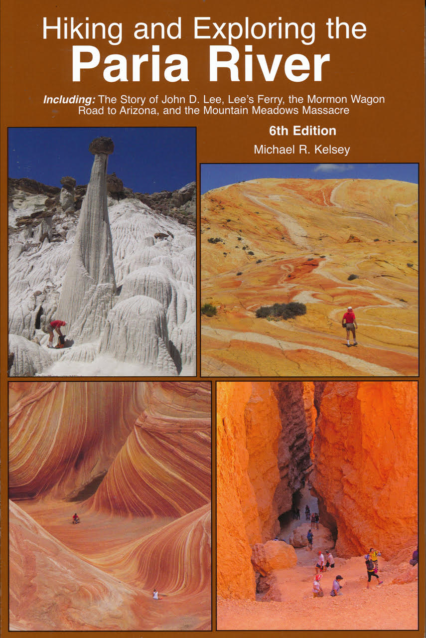
Introducing the enlarged & updated 6th Edition of the book, Hiking and Exploring the Paria River. This edition includes 64 more pages of new hiking areas, fotographic tours, and local history. The new page count is 448. Focusing on the Paria River drainage, this guidebook covers the entrenched canyons from Bryce Canyon south to the Vermillion Cliffs and Lee’s Ferry. Among the 56 maps, you’ll find new information on the Between the Creeks Slots, Hackberry Canyon, Buckskin Gulch, a new route into the middle of the Lower Paria River Gorge, Coyote Buttes, The Wave, the Sand Hills, and White Pockets. In preparation for this new edition, the author interviewed a number of local “old timers” to expand on the guidebook’s already rich regional history. Also added to this 6th Edition, is an enlarged section on John D. Lee along with new information about the Mountain Meadows Massacre and why Lee was sent to the Colorado River to establish a ferry. The reason was, Brigham Young and the Church leadership wanted to create a Mormon Wagon Road into Arizona to establish a mission to the Indians, colonize new lands before the gentiles got it, plus create a corridor to Mexico in case the Mormons were run out again. Adding the Mormon Wagon Road to Arizona is stretching the boundaries of the Paria River, but it seems necessary so that readers can better understand local Southern Utah politics and history. A new segment with 18 pages covers the route, the waterholes and the first 4 settlements created by the Mormons in the late 1870’s along the Little Colorado River.
448 pages, 620 mostly-color fotos, Perfect Bound, 15cms x 23cms (6″x9″), ISBN 978-0-944510-33-9.
US$19.95 (Mail orders $22)
Guidebook Updates and Corrections
The Historic Bull Valley Gorge Bridge–Posted July 1, 2019
Should have put this picture and information in long ago, but didn’t have the time. The Bull Valley Gorge Bridge has collapsed and can’t be used by cars. Someone in the Kane County road 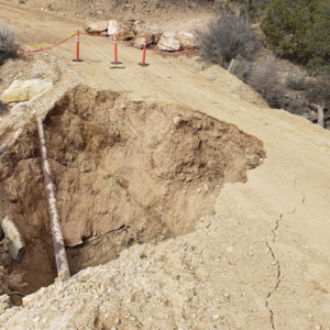 department said they are looking into getting a portable military-type bridge for now. That was a couple of weeks ago. The various tourist offices, and just about anybody in the area, will know if or when the Skutumpah Road will be open. Until it opens, you’ll have to use the Cottonwood Wash/Canyon Road from Highway 89 to Bryce Valley; or take the long way around and go from Kanab through Bryce Canyon NP to reach Tropic and Cannonville.
The Bridge over Bull Valley Gorge–Posted February 3, 2025
Most of this information about the new cement bridge over Bull Valley Gorge comes from Bert Harris of Kanab and the Kane County Roads Department. To start with, they ran a fibre-optic cable the full length of the Skutumpah Road, to tie into a redundant line from Kanab over to Cannonville. It was a very wet year for us here in southern Utah—and just above the bridge, was a steep hill and the rain just saturated that ground—flooding there I think was the reason why the old log bridge was taken out. It was about April 1, 2019, when we first became aware that the bridge had washed out. From then on, it took about a year before we got the new bridge in. But the biggest problem we had was fighting with the Federal Government and all their regulations (the bridge is on BLM land). From the time bridge plans were drawn up, it took us just over a year to get the bridge built. To start with, we first poured some cement footings; then (and it was a kind of prefab bridge over the top of that) we poured concrete on the deck. We finished that on July 24th of 2020. That’s when we made the final pour, but then we didn’t open the road until about a week later because we had to let the cement cure. So, it was about a week to 10 days after we poured the last concrete, that we let traffic go through. I’ve got a picture dated July 29th of my county pickup on the bridge, but we still had to do a little more work—that included pushing dirt up against the bridge. So I would say it was about the 1st of August, 2020, that it was fully opened to the public.
Just got a new hot tip from Bob Ford of Fredonia, Arizona. His email reads: My cousin Ken Button, his son Brandon and I were down in the Paria back in May. Brandon spotted a faint cross on the wall with the initials F. R. we thought (actually F. K.). I researched it and came up with F. Kettleman. You mention him in your book as F. Kittleman with the Wheeler Expedition. I entered him into findagrave and added a couple of pictures, a drawing of the gravesite done by C.D. Gedney in 1872 plus an article out of the Deseret news (Telegraph). Below is a link to his memorial in findagrave. After you click on the link, click on Show Map then click on the satellite view at the bottom left, you can see where the grave is. It is above the Buckskin about a mile and a half where Bridger Canyon comes in. They were further up the Paria than what I would have guessed. Another mile and they would have been in open canyon again.
https://www.findagrave.com/memorial/190190612/f.-kettleman
To read about this event in the 6th Edition of my Paria Guide, go to page 212. Also, go to Map 31, page 191. In the lower right hand part of that map and just below the word Paria, as in Paria River, is where the initials & cross are found. It’s also right where Bridge Canyon comes in from the right or east.
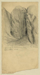 The sketch of the cross, initials & date by C. D. Gedney from 1872, are found along the Paria River above The Confluence of the Paria & Buckskin Gulch.
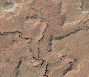 A screen shot from Google, which you can go to from the link above, showing the location of the inscription of Frank Kettleman.
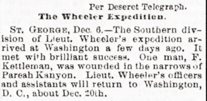 Screen shot of the Desert Telegraph telling of the Wheeler Expedition. This is on the link as well.
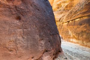 The cross & initials are on the wall of the Paria River Canyon and on the left of this foto by Bob Ford.
The BLM and Vermilion Cliffs N.M. are seeking input into a new policy being drafted regarding PERMITS FOR THE WAVE IN COYOTE BUTTES
If you’re sick & tired of the permit & quota system for The Wave and all of the Coyote Buttes, you have until August 14, 2015 to give them an earful. This writer believes all permits should end–and anyone going there should be able to go on the day of their choice–not the choice of the powers that be! Also, the money taken in by a fee should be used for something more useful–like building a toilet in that area. Hoping many of you feel the same way. So send in your opinions via email to blm_az_vcnm@blm.gov as soon as possible. Posted July 31, 2015
The North Coyote Pasture (or Blue Cove Pond) Road going to the Wahweap Toadstools May or May not be Open?
Just talked to Ralph Chynoweth of Henrieville yesterday (4/19/2017) and he says someone–likely the county road crews–fixed up the rough place where you turn east toward the Toadstools. See Map 30B, page 186. A short distance beyond that and the dry wash, is a gate with a sign that says, “For Administrative Use Only”; but Ralph says there’s a lot of traffic going past it anyway. The fate of this road and others, is in court (Kane County vs USA), and no one knows when the war between Kane County and the Monument BLM will end. Ralph testified in some kind of hearings (?) in 2013, and stated that road and the 5 stock ponds have been there since at least the 1940’s So he and others believe that is a real road and can’t be closed–like the Monument BLM is trying to do. During the summer of 2017, the author talked to an informed person about whether or not the M. BLM would issue a ticket if you went past the unlocked gate; he said they really can’t and/or don’t since it’s in court? But this writer can’t guarantee anything?–only that there is a lot of traffic and people practicing a little civil dissobideance going toward the Toadstools from the west as shown on Map 30B. This writer believes the M. BLM should go after the ATV-4Wheeler crowd and close the roads or tracks they are making and leave the North Coyote Pasture/Blue Cove Pond Road alone. Whether you obey that sign is up to you, but apparently a lot of people are ignoring the sign and the futility of the M. BLM. Updated April 20, 2017
Good News for Paria Hikers in the Vermilion Cliffs and Paria Canyon–New Map Available
Art Janssen now of Page, Arizona, has just sent this writer a copy of the latest map from National Geographic/Trails Illustrated. It’s titled, Paria Canyon, Kanab (subtitled) Vermilion Cliffs National Monument Grand Staircase-Escalante NM, Number 859. The format is the same as with all other NG/TI maps in that it is made or some kind of plastic, is waterproof, and is at 1:75,000 Scale. The cost is US$11.95. It’s 2-sided; on one side it covers the country south of Kanab, Utah, and Highway 89 as far as Snake Gulch and all its rock art. The other side covers the next section east, and all the land south of Highway 89; it includes the lower Paria River Gorge, the Sand Hills/Paria Plateau and the Vermilion Cliffs National Monument. On the southern border is Highway 89A. On the east it doesn’t quite reach Page, Arizona, but does include Thousand Pockets.
At first glance, this would be the best map available which shows all of the Sand Hills country on just one easy-to-read map. For orientation to this area, it’s good. For the most part this is a must have map, but the researchers may not of gone out there and explored as much as they should have. Art Janssen made the statement; “Multiple Road Errors–roads that exit aren’t on the map. Roads on map that I couldn’t see. One Road # error. Big Sink is Confusing on this map.” However, at first glance, that part of this map of the Sand Hills appears to be about the same as this author’s, Sand Hill Area Map on page 219 of his 5th Edition (or on page 251 of the new 6th Edition). NO MAP IS PERFECT. But it should be good as a driving map–if you want detail, use the 7 1/2′ quads. Another thing to keep in mind, the cattlemen who run cows out there, will use most roads in a given fenced pasture for 2-3 months, then when they move cows to another pasture, they won’t use the roads in the previous fenced area for another 2 years or so. In some cases, some tracks will got back to nature and will be hard to locate.
Comments on hikers dying while going to The Wave
Please read the newspaper articles below. Recently (summer 2013), and in hot weather, 3 people have died going to or returning from The Wave in the Coyote Buttes of the Sand Hills/Paria Plateau. And it all has to do with BLM policy. First of all, people like Mike Salamanca and others, are always kicking over cairns that hikers erect to help mark the way to or from The Wave–which is not an easy place to find! The land managers reasoning is, they want you to have a wilderness experience–according to their definition. Well, this is the only place in the world it seems where land managers don’t want a single trail to a popular destination. Normally they want one trail and hope that everyone stays on it rather than having a dozen paths. The second issue is, and in keeping with the idea that everyone should have a wilderness experience, for years they have issued only 20 permits a day to visit the place. But, is going out there with 19 other people a wilderness experience? This 2nd issue can be solved by eliminating the quota system altogether and allow as many people go there as show up on any given day. It takes most people these days 2-3 years to get a permit, which means no matter what the conditions are like on the day of their permit, they’re going out there regardless–come Hell or High water! Instead, simply have a ranger at the parking lot collect $5/head and let them go. On same days, and at some times, people may have to direct traffic to get their picture, but at least that will eliminated the forbidden fruit effect of going to The Wave. And of course, mark the route well with cairns so people can get in & out quickly without getting lost.
BLM considers changes at The Wave after recent fatalities After 3 hikers die in July heat, BLM officials consider several safety measures.
By Matthew Piper, The Salt Lake Tribune First Published Jul 23 2013 05:26 pm • Last Updated Jul 23 2013 10:13 pm The Bureau of Land Management is evaluating safety options after Monday’s fatality brought to three the number of people who have died hiking this month near The Wave rock formation, known worldwide for its scooped-out valleys of vibrant sandstone. Among the wide range of options being considered: adding trail markers, boosting cellular phone coverage, increasing access permits, and, contrarily, periodically closing the wilderness area to visitors altogether. But there is no set timetable for change, and hikers will still bear responsibility for their own safety. “It is going to be a rugged, remote location,” warned BLM public affairs officer Rachel Tueller. “There’s still always going to be a need to prepare.” The striped, undulating slopes of The Wave resemble a stormy sea, with walls that look like clay suspended in motion on a potter’s wheel. A natural draw for photographers, the remote section of Vermilion Cliffs National Monument was relatively obscure until it gained widespread popularity over the last 10 to 15 years, said Kane County Sheriff’s chief deputy Tracy Glover. Last year saw more than 48,000 people apply for just 7,300 permits to hike to the formation on a 6-mile round trip that begins in Utah and ends in Arizona. “The unusual thing about The Wave is it’s a destination within a wilderness area, so there’s limited resources,” Glover said. “It’s also an area that’s kind of a bucket list item, for lack of a better term, and some of the folks are not avid hikers.” Glover said that online reviews often bill the hike as undemanding, but “what’s easy for you isn’t necessarily easy for me.” The terrain is fairly exposed to the elements, people must traipse through deep sand at times, and there is no formal trail. The nearest emergency resources — in Page, Ariz., and Kanab — are more than 45 miles away. And while efforts are made to keep visitors safe, BLM’s central mission in the wilderness area is stewardship of the land. On Monday, 27-year-old mother of two Elisabeth Ann Bervel died while hiking with her husband on their fifth wedding anniversary, less than a month after Ulrich and Patricia Wahli — 70 and 69, respectively — died of heat exhaustion as temperatures exceeded 100 degrees. A sheriff’s office news release says the Bervels, from Mesa, Ariz., began the trek at 8 a.m. They lost the trail on the return leg during peak temperatures before Elisabeth Berval grew tired and collapsed. Anthony Bervel, who had applied for the permit with his wife for three consecutive years, hiked into cellphone range and called authorities, but medics flying from Page found the woman in cardiac arrest and were unable to revive her. “In interviewing [Anthony], he was fairly confident that they knew what they were doing,” Glover said. “They were prepared.” Oddly, Monday wasn’t a particularly hot July day by southern Utah desert standards, Glover said, though perhaps it was a little bit more humid than usual. Nonetheless, Glover said the sheriff’s office believes the medical examiner will find that the cause of death was related to the heat. On July 4, the Wahlis, of Campbell, Calif., were found dead in a similarly harrowing scenario — Ulrich Wahli 250 yards away from his wife, who had apparently stopped to rest under a tree. Glover and BLM officials were only aware of one other fatality in The Wave’s recent history, when a hiker fell from a canyon rim after becoming lost at night in July 2011, but Glover said people frequently lose their way and require assistance. “We have a few close calls,” he said. “In particular, from people who are more interested in carrying their camera equipment than the appropriate supplies.” The Bureau of Land Management recommends a gallon of water per person, salty snacks and sunscreen. Many hikers opt to go it alone (though professional guides are available), but permits come with a map that includes compass points and photos of key navigational points. To get an online permit, hikers must first watch a safety video, and 10 daily “walk-in” permits mandate a 24-hour wait for visitors to study up. The BLM also added a volunteer safety patrol in 2012 to carry water and provide assistance to hikers, though “it shouldn’t be relied upon,” Tueller said. “It’s sporadic.” But since those standards didn’t prevent the recent tragedies, BLM officials are asking how they can do more. Managers from three BLM offices are involved in the safety discussions, and Tueller said a third-party review may also be conducted. Glover said he is aware of some of the options on the table, and he has shared his own thoughts. “I would like to see some trail markers added, and I’ve expressed that to the BLM,” Glover said, adding that, “It’d be great in my opinion if we could enhance cellular telephone coverage in that area.” Glover said the BLM is also considering increasing the permit total (people on the trail often help each other stay on course) and that there is talk of closing the park altogether for stretches. Tueller thinks closures are probably unlikely because the trailhead provides access to other popular areas like Buckskin Gulch and there is no telling when extreme heat will come. It was actually hotter on July 4 than July 22 this year, for instance. “It would be a guessing game,” she said.
Woman dies while hiking The Wave in high heat
By Erin Alberty, The Salt Lake Tribune, First Published Jul 22 2013 10:22 pm • An Arizona woman died while hiking in high temperatures to The Wave rock formation in Kane County. Elisabeth Ann Bervel, 27, was hiking with her husband Anthony on Monday, their fifth wedding anniversary. They had secured hard-to-get permits for the Paria Canyon-Vermilion Cliffs Wilderness hike in a lottery seven months ago, deputies wrote in a press statement. “They had spent the last seven months preparing for the trip by reviewing the information provided by a BLM informational packet about the hike as well as online reviews by other hikers trying to make sure they were prepared for the outing,” according to the statement. The Bervels began their hike about 8 a.m. and met other hikers along the way. On their hike back to the trailhead, they lost the trail occasionally and spent “a couple of extra hours” hiking during the hottest part of the day, deputies wrote. “The … hours in the heat and hiking in the sand took their toll on Elisabeth and her legs finally gave out and she could go no farther,” deputies wrote. Her husband hiked ahead to reach a cellphone signal and called for help. Medics flew to The Wave from Page, Ariz., but she was in cardiac arrest when they arrived. The medics tried CPR but could not revive her. An autopsy is pending, deputies said. The Bervels have two sons, 4 and 5, who were with relatives in Arizona. “This event once again demonstrates the inherent risks associated with hiking in southern Utah’s desert country this time of year,” deputies wrote. “Even though the Bervels had tried to make sure they were prepared for this hike, the elements proved to be stronger.” Four people have died while hiking in Kane County this year; Ulrich and Patricia Wahli, of Campbell, Calif., died July 3, also near The Wave. Another person died near Hole-In-The-Rock Road south of Escalante, deputies said. The Wave is a popular photo subject and hiking destination that allows only 20 visitors’ permits each day. Ten permits are reserved in advance, and 10 are issued each day in a lottery at the Grand Staircase-Escalante visitor’s center in Kanab, Alldredge wrote; up to 100 people have arrived at the visitor’s center for a single day’s lottery. Last year, more than 48,000 people applied for the 7,300 available tickets.
California couple dies on route to popular rock formation–The Wave
Paul Foy, THE ASSOCIATED PRESS SALT LAKE CITY — A lottery system for hikers makes it difficult for many to win a permit to visit a rock formation called The Wave — and that may have colored the judgment of a couple who set out in brutal heat and were found dead along the trail. Ulrich and Patricia Wahli, of Campbell, Calif., had permits to hike the 3 miles across open country in blazing heat and in energy-sapping deep sand. Authorities said they apparently succumbed to temperatures that reached 106 degrees on Wednesday. The U.S. Bureau of Land Management allows only 20 hikers a day to visit The Wave’s dramatically flowing sandstone contours at Vermilion Cliffs National Monument in Arizona, near the Utah border. Hikers have to enter a lottery months in advance, often to their disappointment. The U.S. Bureau of Land Management says the odds of winning a permit to The Wave are as low as 10 percent, making it tempting to ignore the dangers. More than 48,000 people applied last year for 7,300 of the available hiking permits, The Salt Lake Tribune reported. The Wave is a richly colored geological upheaval, its fiery swirls emblazoned on countless postcards, posters, maps and computer screensavers. The couple’s bodies were found Thursday morning by other hikers. Ulrich Wahli was 70; his wife, 69. The lottery system may be the only way to go for a wildly popular backcountry spot, wilderness guides say. But a winning ticket encourages many to grab a once-in-a-lifetime opportunity regardless of the dangers. Guides say they can’t help because they are prohibited from running trips inside national parks or monuments. “The law of averages takes it from there,” said Mike Banach of Zion Mountain School in Springdale, Utah. “People go out who aren’t suited to the heat, and they don’t bring enough water or equipment.” Kane County sheriff’s Sgt. Alan Alldredge said The Wave isn’t an easy place to reach; no marked trail leads the way. Monument officials say only a few juniper trees provide shade along the open route. “Add that to the high heat we are experiencing right now, and it makes for a lethal combination,” Alldredge said Thursday in a statement. “If you must hike, it is best to do it early in the morning, and make sure you have enough water and supplies.” The BLM does its best to educate visitors on safety, said Kevin Wright, manager of Vermilion Cliffs National Monument. He said the hiker limit is necessary to protect the rock formations and preserve a sense of wilderness at The Wave. A lottery system is the only way to govern crowds, he said. “We don’t even know what caused these fatalities, which are obviously a tragedy,” Wright said Friday. “We are going to see what the cause was, then review our policies and procedures.” Ulrich and Patricia Wahli were “avid travelers and fairly capable folks,” said Tracy Glover, chief deputy of the Kane County Sheriff’s Office. The AP was unable to locate any family members or friends of the couple who might have known their intentions. “I don’t know that the lottery is a problem,” Glover said Friday. “I’m not going to throw the BLM under a bus.” Patricia Wahli was found under a tree “as though she was trying to find some relief from the heat,” Alldredge said. Ulrich Wahli was found 250 yards away, apparently in the open. The bodies were sent to the Utah State Medical Examiner’s Office for an autopsy. Temperatures reached 106 Wednesday afternoon at nearby Page, Ariz., dipping to an overnight low of 80 degrees, the National Weather Service said. July 3, 2013.
